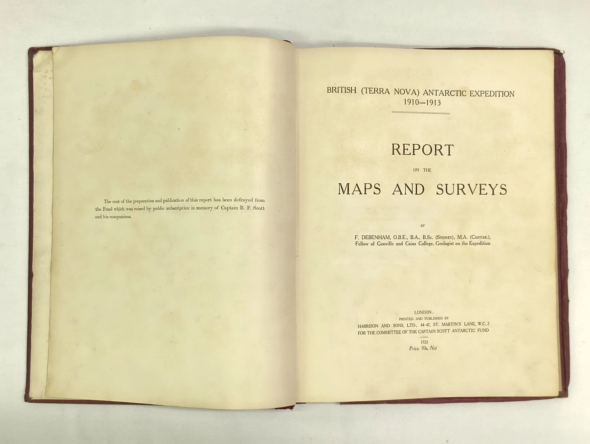
British (Terra Nova) Antarctic Expedition, 1910-1913: Report on the Maps and Surveys. (First Edition)
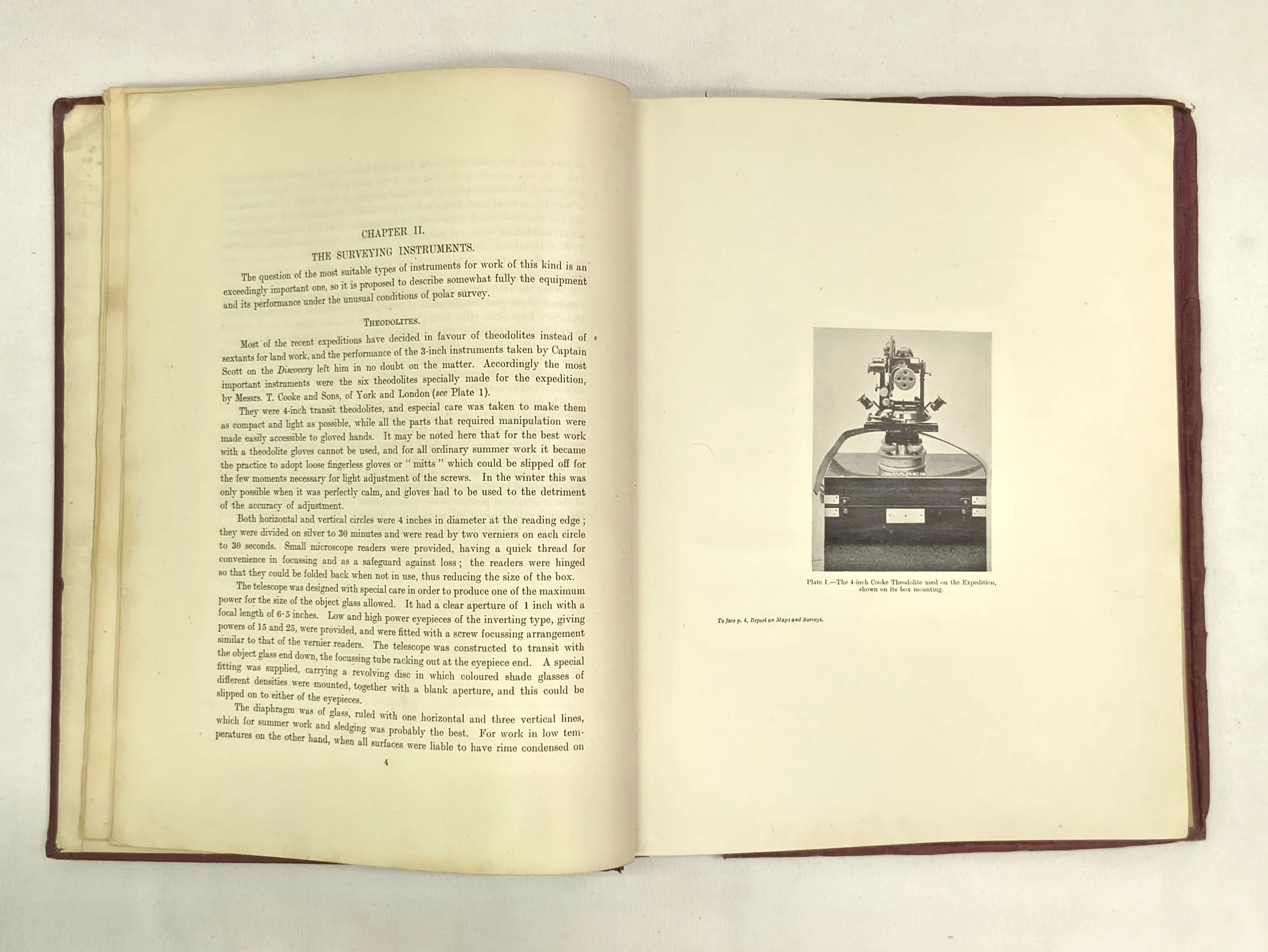
The extremely rare cartographic record from the British (Terra Nova) Antarctic Expedition, 1910-1913. This report forms part of a series of issued publications covering the enormous amount of scientific data generated through the course of the expedition. Issued and funded by the Captain Scott Antarctic Fund, it contains detailed descriptions of the equipment used to gather the data, maps of the surveyed areas, and detailed breakdowns of the data gathered.
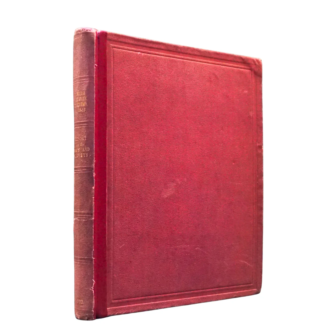
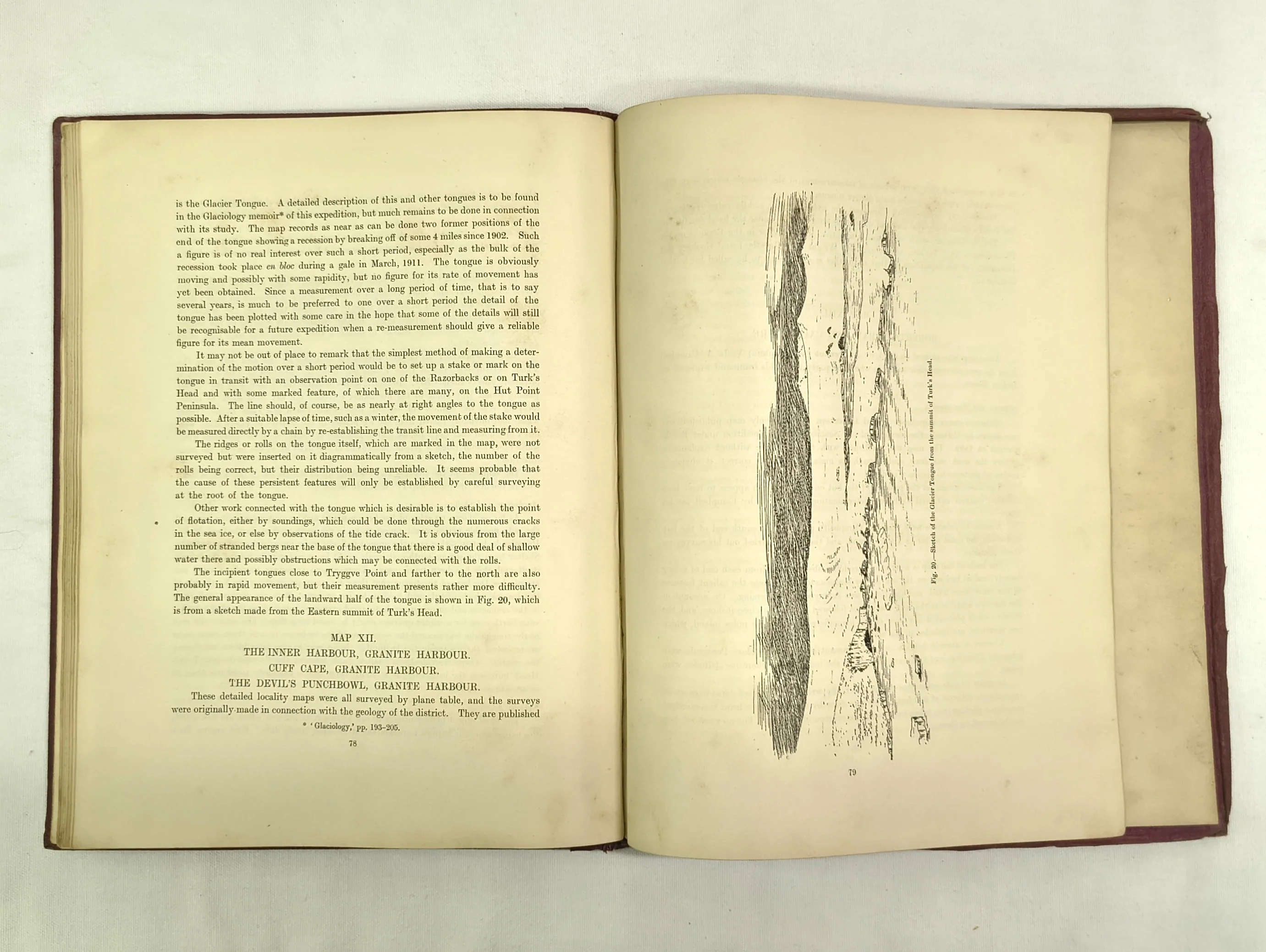
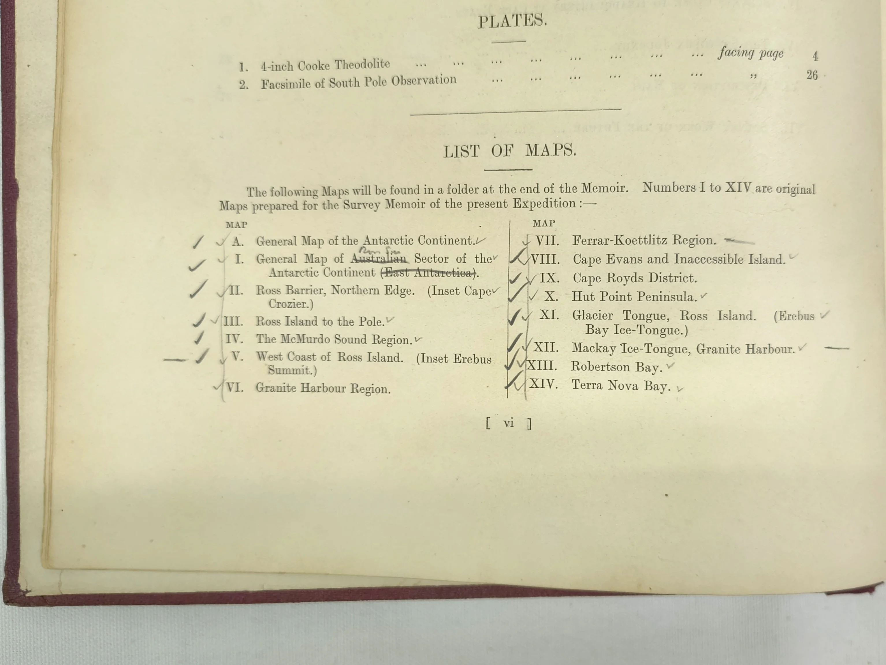
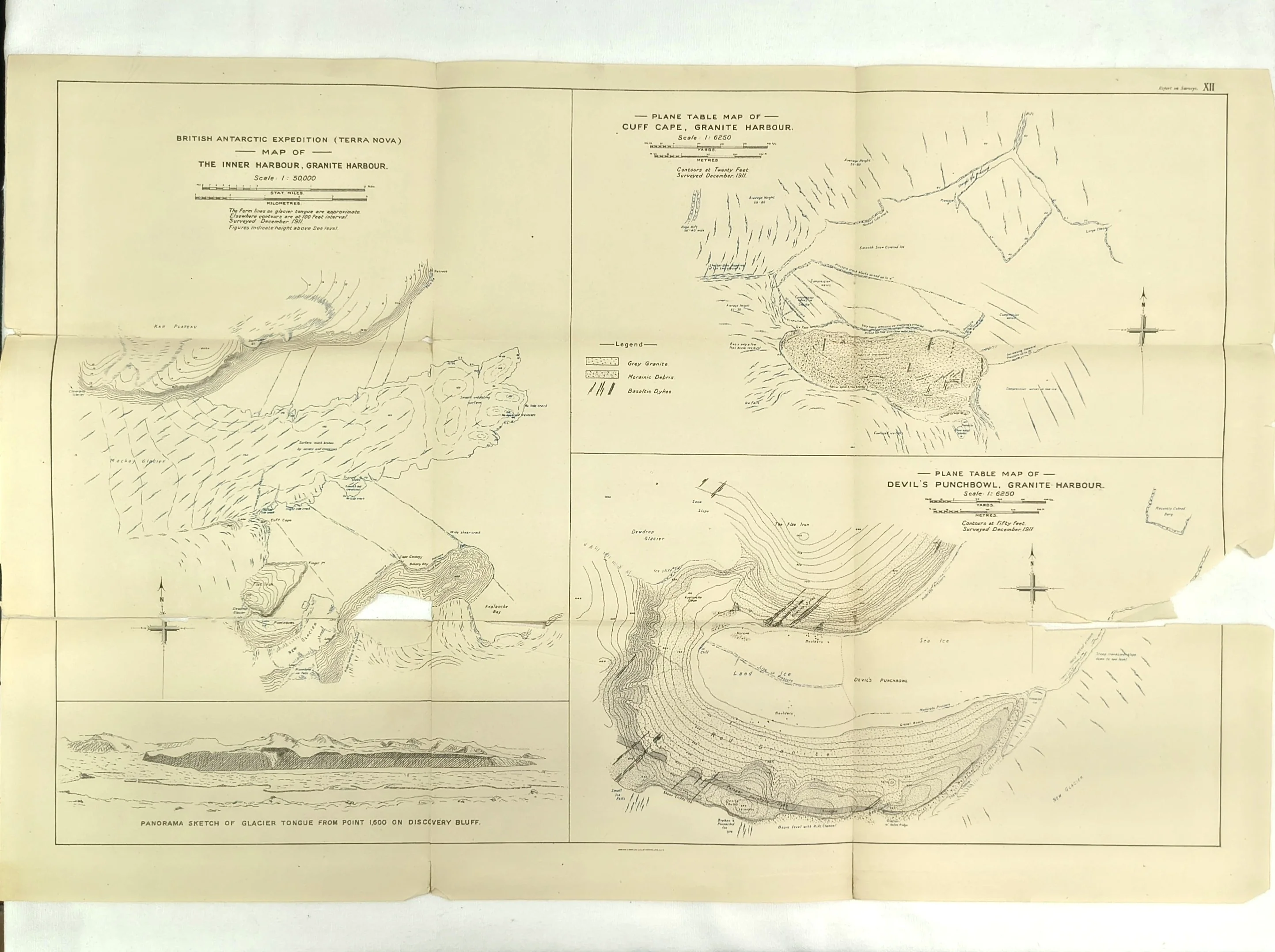
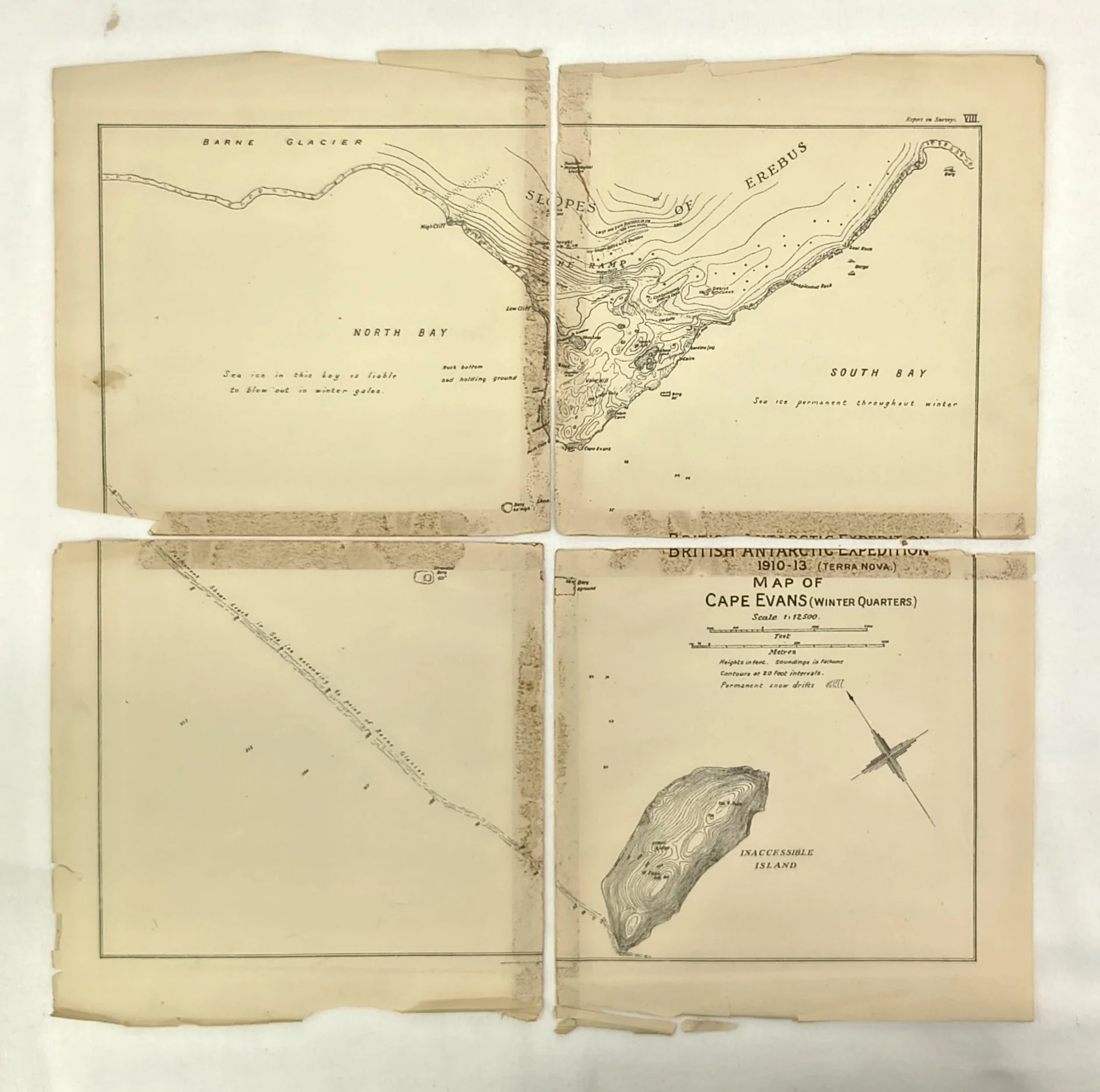
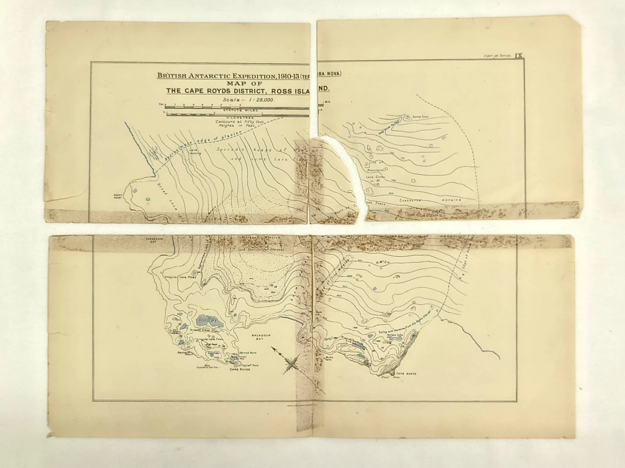
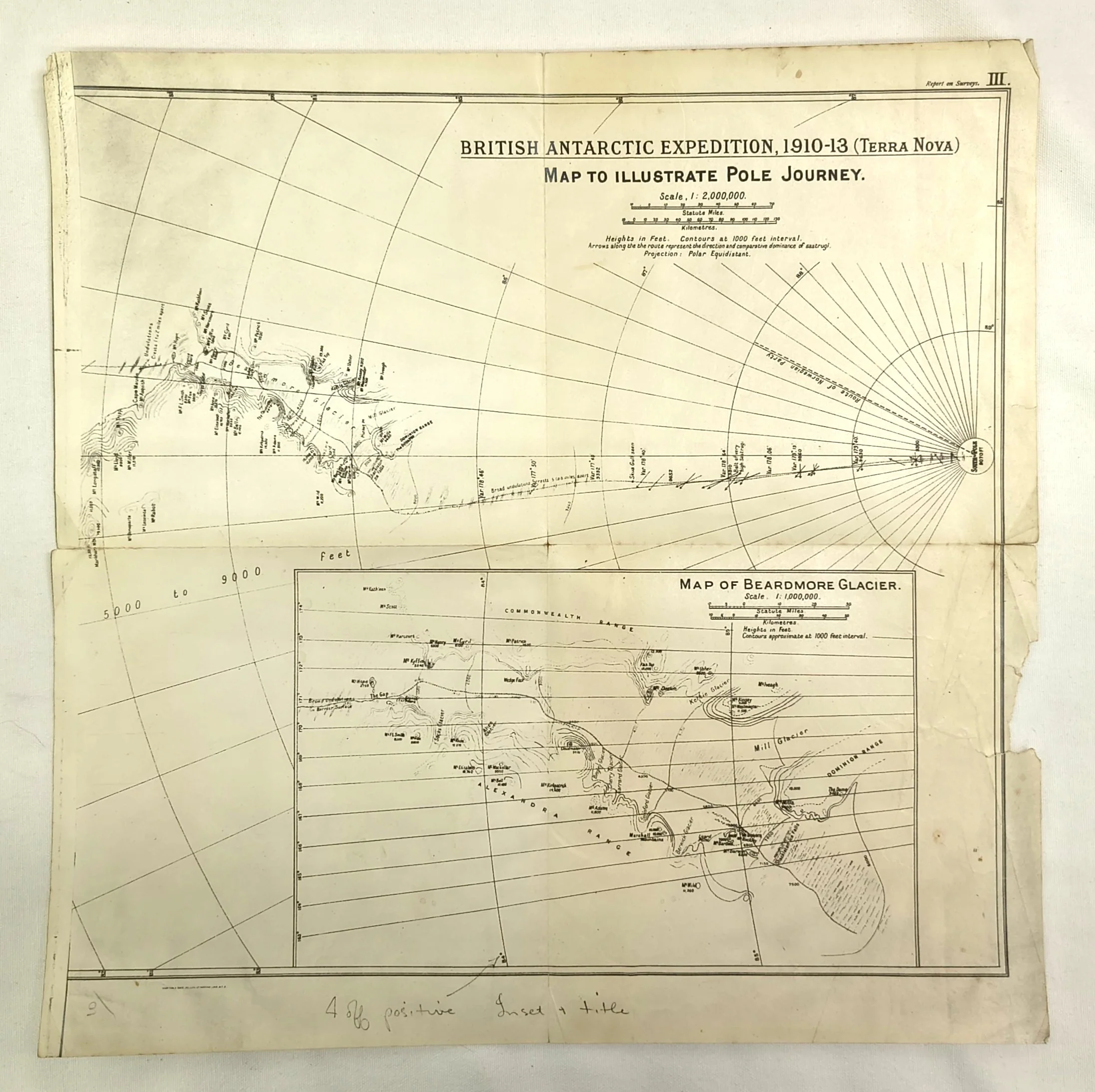
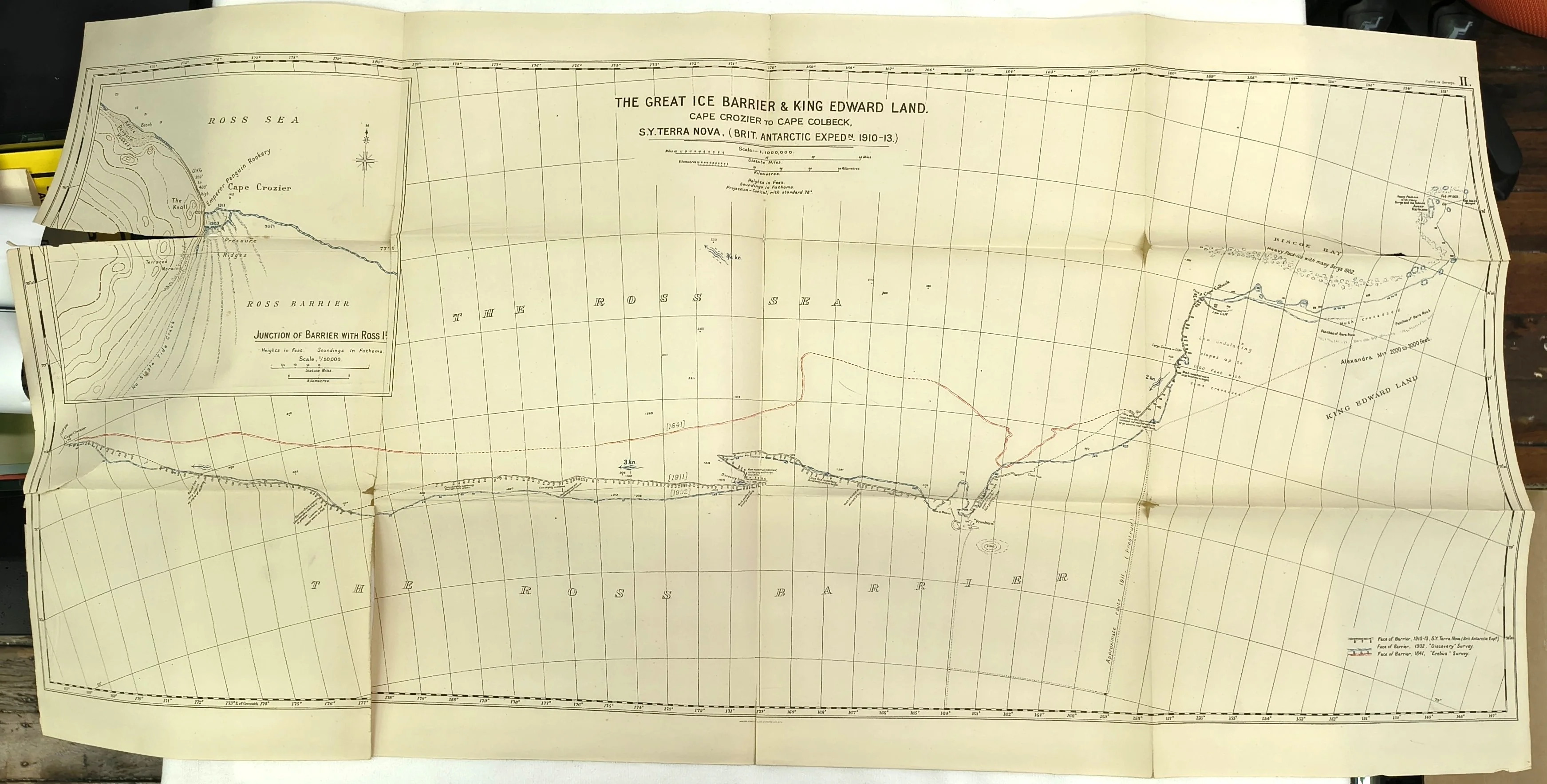
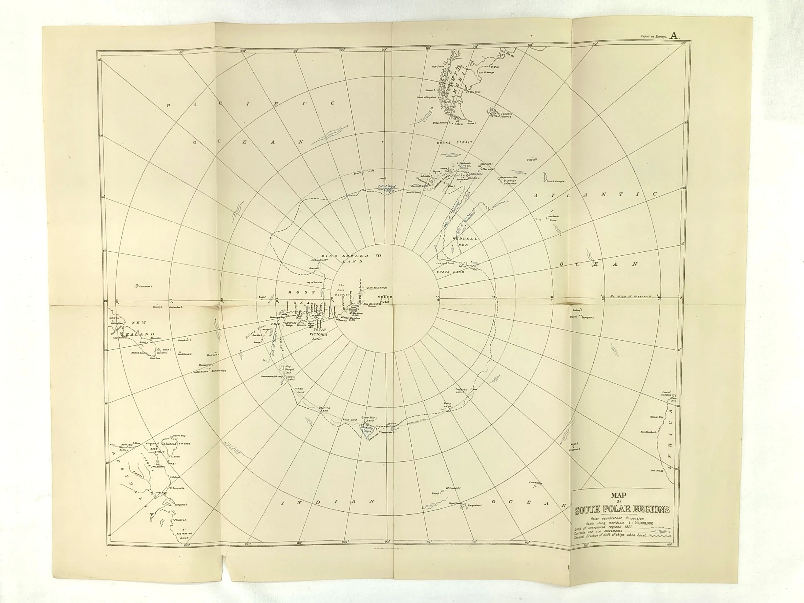
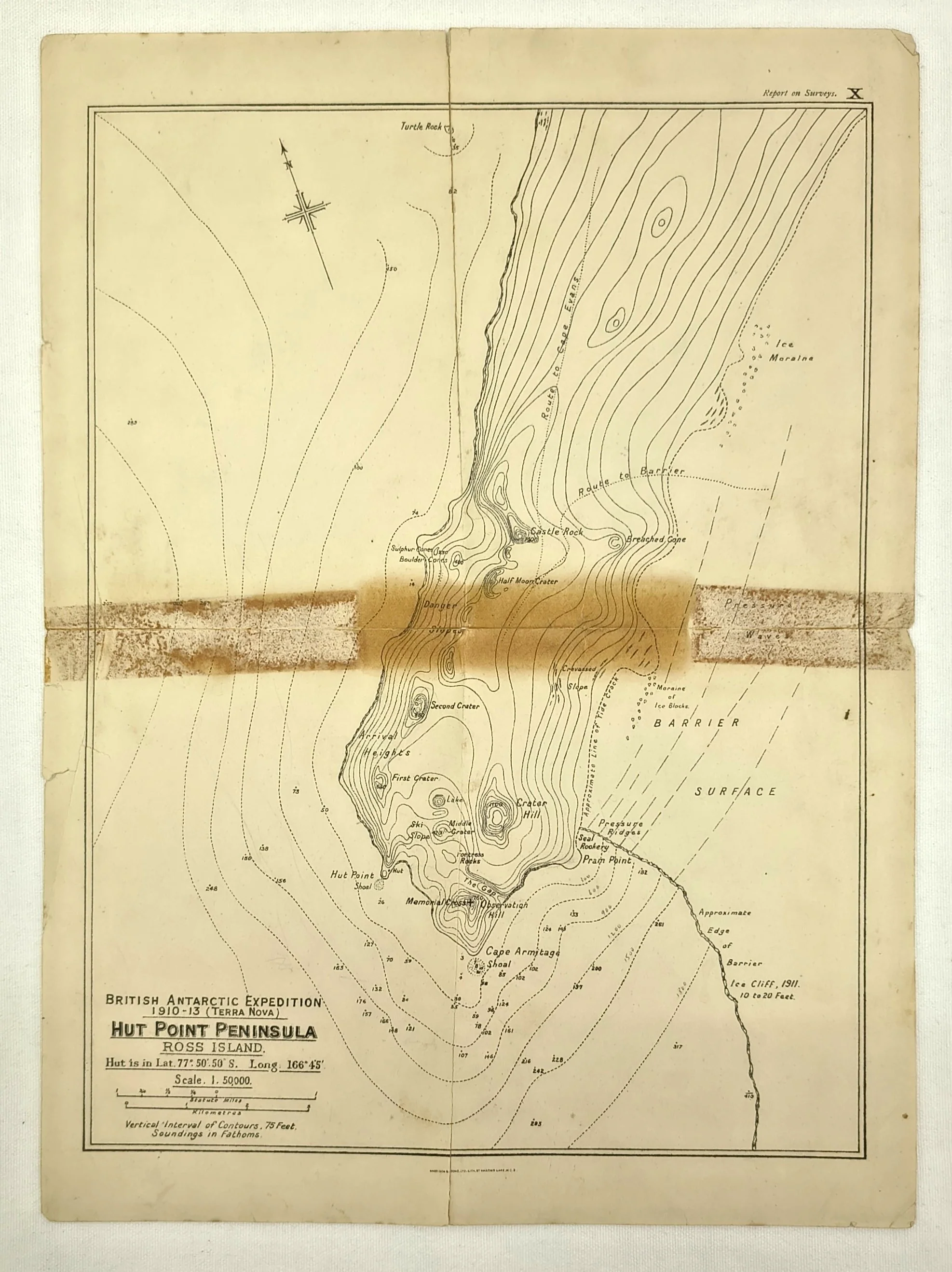
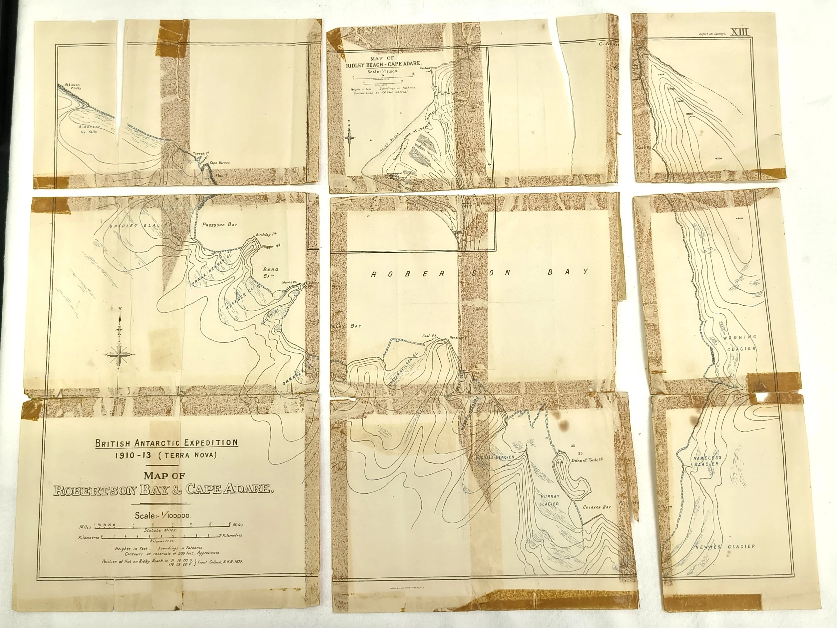
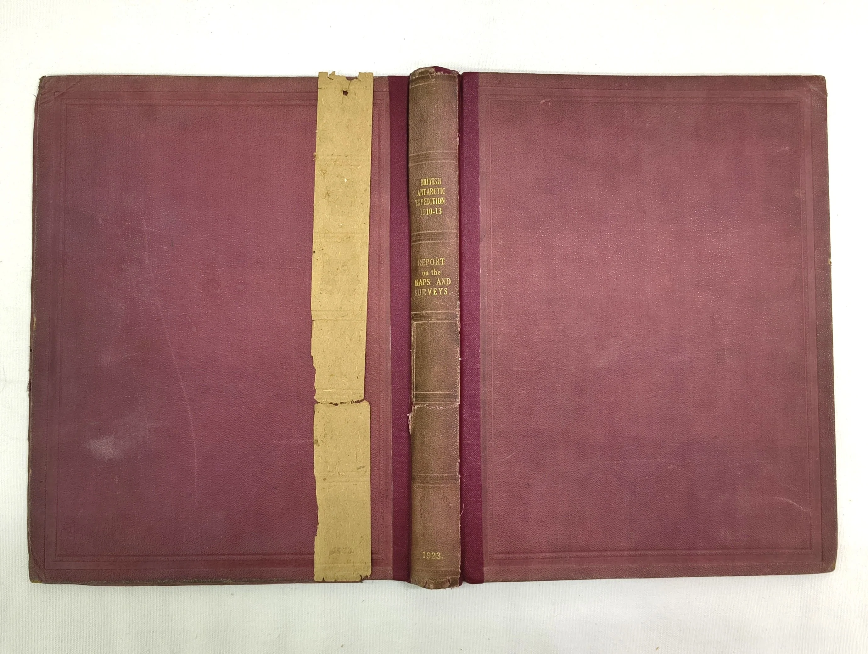
First edition. London: Harrison and Sons, 1923. 4to. Re-backed, preserving original red publisher's cloth. Pages: viii, 94pp. Numerous maps (some missing - see images).
Bound in re-backed red publisher's cloth, preserving original spine strip. Lettering to spine stamped in gilt. Cover margins ruled in blind. Fair. Binding has been rebacked with red cloth tape. Contents incomplete, some maps missing (see image of map list). Textblock generally in very good condition, some toning and foxing here and there. Maps vary in condition from good to damaged and separated. A working copy priced as such.
Provenance: From the library of Warwick H. Williams.
This book is currently on display in the rare book section of our Paddington store.
If you would like more information or to arrange a viewing, please contact: [email protected]
Catalogue Number: ON00136
Product Information
Product Information
Shipping & Returns
Shipping & Returns
British (Terra Nova) Antarctic Expedition, 1910-1913: Report on the Maps and Surveys. (First Edition)
British (Terra Nova) Antarctic Expedition, 1910-1913: Report on the Maps and Surveys. (First Edition)
The extremely rare cartographic record from the British (Terra Nova) Antarctic Expedition, 1910-1913. This report forms part of a series of issued publications covering the enormous amount of scientific data generated through the course of the expedition. Issued and funded by the Captain Scott Antarctic Fund, it contains detailed descriptions of the equipment used to gather the data, maps of the surveyed areas, and detailed breakdowns of the data gathered.
First edition. London: Harrison and Sons, 1923. 4to. Re-backed, preserving original red publisher's cloth. Pages: viii, 94pp. Numerous maps (some missing - see images).
Bound in re-backed red publisher's cloth, preserving original spine strip. Lettering to spine stamped in gilt. Cover margins ruled in blind. Fair. Binding has been rebacked with red cloth tape. Contents incomplete, some maps missing (see image of map list). Textblock generally in very good condition, some toning and foxing here and there. Maps vary in condition from good to damaged and separated. A working copy priced as such.
Provenance: From the library of Warwick H. Williams.
This book is currently on display in the rare book section of our Paddington store.
If you would like more information or to arrange a viewing, please contact: [email protected]
Catalogue Number: ON00136
Original: $233.55
-65%$233.55
$81.74Product Information
Product Information
Shipping & Returns
Shipping & Returns
Description
The extremely rare cartographic record from the British (Terra Nova) Antarctic Expedition, 1910-1913. This report forms part of a series of issued publications covering the enormous amount of scientific data generated through the course of the expedition. Issued and funded by the Captain Scott Antarctic Fund, it contains detailed descriptions of the equipment used to gather the data, maps of the surveyed areas, and detailed breakdowns of the data gathered.
First edition. London: Harrison and Sons, 1923. 4to. Re-backed, preserving original red publisher's cloth. Pages: viii, 94pp. Numerous maps (some missing - see images).
Bound in re-backed red publisher's cloth, preserving original spine strip. Lettering to spine stamped in gilt. Cover margins ruled in blind. Fair. Binding has been rebacked with red cloth tape. Contents incomplete, some maps missing (see image of map list). Textblock generally in very good condition, some toning and foxing here and there. Maps vary in condition from good to damaged and separated. A working copy priced as such.
Provenance: From the library of Warwick H. Williams.
This book is currently on display in the rare book section of our Paddington store.
If you would like more information or to arrange a viewing, please contact: [email protected]
Catalogue Number: ON00136